


Shipwrecking Probability in Mediterranean Territorial Waters
A cultural approach to archaeological predictive modelling
Manuela Ritondale | Forthcoming
Shipwrecking Probability in Mediterranean Territorial Waters
A cultural approach to archaeological predictive modelling
Manuela Ritondale | Forthcoming
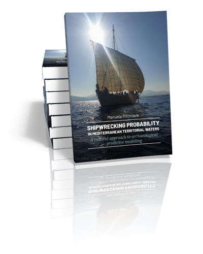
Paperback ISBN: 9789464281385 | Hardback ISBN: 9789464281392 | Imprint: Sidestone Press Dissertations | Format: 182x257mm | ca. 320 pp. | Language: English | 10 illus. (bw) | 50 illus. (fc) | Keywords: maritime archaeology; ancient seafaring; shipwreck probability; archaeological predictive modelling; GIS modelling; cost-surface analysis; coastal navigation; archaeological risk-assessment | download cover | DOI: 10.59641/w1z7t8u9v0
Publication date: 28-10-2026
-
Digital & Online access
Digital/Online version not (yet) available
-
Buy via Sidestone (EU & UK)
Get €5.00 discount on forthcoming books by using coupon code "PRE-ORDER" in your shopping cart!
-
Buy via our Distributors (WORLD)
For non-EU or UK destinations you can buy our books via our international distributors. Although prices may vary this will ensure speedy delivery and reduction in shipping costs or import tax. But you can also order with us directly via the module above.
For UK & other International destinations
For USA/Canada & other International destinations
-
Bookinfo
Paperback ISBN: 9789464281385 | Hardback ISBN: 9789464281392 | Imprint: Sidestone Press Dissertations | Format: 182x257mm | ca. 320 pp. | Language: English | 10 illus. (bw) | 50 illus. (fc) | Keywords: maritime archaeology; ancient seafaring; shipwreck probability; archaeological predictive modelling; GIS modelling; cost-surface analysis; coastal navigation; archaeological risk-assessment | download cover | DOI: 10.59641/w1z7t8u9v0
Publication date: 28-10-2026

We will plant a tree for each order containing a paperback or hardback book via OneTreePlanted.org.
Maritime mobility has long been the predominant means of travel and transport. For millennia, ships have crossed the Mediterranean Sea for trade, migration, warfare, worship, pilgrimage, and cultural exchange. Yet this vast maritime landscape is also a place of loss. Thousands of ships have sunk in its waters and along its coasts, leaving a submerged archaeological record that remains only partially known due to logistical and economic challenges associated with extensive maritime excavations. Understanding where shipwrecking events were most likely to occur contributes to the scholarly study of ancient seafaring while also providing practical support for maritime archaeologists, developers, and cultural heritage managers in planning and optimising underwater archaeological surveys.
This book explores the dynamics affecting seafaring practices in Classical times and the factors contributing to ship losses, asking where such losses were most likely to occur in antiquity. Focusing on Mediterranean territorial waters, it examines how environmental conditions, coastal geography, and human decision-making shape the risks of shipwrecking, particularly in coastal areas, where the safety of sailing near shore versus offshore remains controversial and widely debated. Grounded in archaeological and textual evidence, the study introduces a computational model designed to estimate the relative probability of shipwrecking across the Mediterranean. The analysis operates at two spatial scales. The first is a regional model focusing on navigation dynamics in the area between Cap Bon (present-day Tunisia) and Alexandria (present-day Egypt) during Roman times. This model is subsequently extended to all Mediterranean territorial waters in a simplified version, without chronological constraints. Particular attention is given to the role of risk perception and its possible divergence from actual nautical hazards—an aspect that has so far received limited attention but may have a significant impact on identifying areas with the lowest and highest probabilities of shipwrecking.
1. Introduction
1.1 Archaeological prediction in maritime contexts: challenges and opportunities
1.2 Objectives and research questions
1.3 Rationale and scope
1.3.1 Challenges and pitfalls of a global theory: tuning temporal and geographical scales
1.3.2 Why focus on shipwrecking probability
1.3.3 Why focus on territorial waters
1.4 Outputs and methodology
1.5 Research outline
2. State of the art in archaeological predictive modelling
2.1 Review of theories and methods of archaeological predictive modelling
2.1.1 History and theoretical background
2.1.2 Definitions: main distinctions in methodological approaches
2.1.3 Main criticisms
2.2 Review of predictive models for shipwreck locations
2.2.1 Paucity of predictive models in the maritime context: whys and wherefores
2.2.2 Theoretical underpinnings
2.2.3 Predictive models for shipwreck locations in the Mediterranean basin
2.2.4 Predictive models for shipwreck locations outside the Mediterranean
2.2.5 Models predicting past seaborne movement
2.2.6 Main limitations of current models
2.3 From limitations to suitable modelling trajectories
2.4 Summary
3. A dive into shipwreck data biases: exploratory analysis
3.1 Building an integrated relational shipwreck database and geodatabase to support EDA
3.2 Shipwreck records: the meaning of absence
3.3 Quality assessment: testing locational uncertainty and differences between sources
3.4 Implications for predictive modelling
3.5 Summary
4. Theory development: a new take on maritime prediction
4.1 Coastal navigation: shortcomings and ambiguities in theories and practices
4.2 Coastal proximity in scholarship
4.2.1 A land of opportunities or a mortal hug: dangers and benefits of coast approaching
4.2.2 ‘You who mistrust both land and sea’: subjective perceptions
4.2.3 Do I want to see what I see? Implications of mutual visibility
4.3 A review of accounts in primary sources
4.3.1 Shelters providing conditional refuge
4.3.2 More or less secure anchorages
4.3.3 Clear, fresh, sweet waters
4.3.4 Unfavourable landmarks
4.3.5 Scent of a shore: creatures of the sea and further indicators of coastal proximity
4.3.6 Seamanship and risk management
4.4 Insights gained and implications for modelling approaches
4.5 Summary
5. A formal model to assess shipwrecking probability in territorial waters
5.1 Theoretical model underpinnings: dealing with a logical conundrum
5.2 Criteria for factor selection
5.3 First component: transit probability
5.3.1 Landing places and anchorages
5.3.2 Port attractiveness
5.3.3 Inland network
5.3.4 Implications of mutual visibility: assault probability and wayfinding
5.3.5 Other indicators of coastal proximity
5.4 Second component: nautical hazards
5.4.1 Geomorphological hazards
5.4.2 Severe meteorological and oceanographic conditions
5.4.3 Past climatic variations
5.5 Brief historical introduction to the regional perspective
5.5.1 Reasons for choosing the north-eastern African coast as a case study
5.5.2 The Stadiasmus as a source for implementing port attractiveness
5.6 A global perspective: designing a simplified Mediterranean-scale model
5.7 Summary
6. GIS implementation of the formal model
6.1 Methodology
6.2 Transit-probability. Regional scale
6.2.1 Landing sites
6.2.2 Port attractiveness
6.2.3 Inland network: proximity to roads and water sources
6.2.4 Assault probability and orientation potential
6.3 Nautical hazards
6.3.1 Geomorphological hazards
6.3.2 Severe meteorological and oceanographic conditions
6.4 Establishing a base model and a preferred model
6.4.1 Factor weights evaluation through Saaty’s Analytic Hierarchy Process
6.4.2 Factor weights calculation
6.5 Comparing actual and perceived optimal routes
6.6 From regional to global: implementing a simplified Mediterranean-scale model
6.6.1 A simplified Transit-probability model
6.6.2 Factor weights assignment and generation of a Base and Preferred Global scales models
6.7 Preliminary interpretation of model outcomes
6.8 Summary
7. Quality assessment
7.1 Methodology assessment
7.1.1 Model-operations uncertainty
7.1.2 Variables-choice uncertainty
7.2 Sensitivity assessment: To which factor is the model more sensitive?
7.3 Robustness assessment
7.3.1 Number of classes and classification method
7.3.2 Testing risk classes against shipwreck locations
7.4 Testing the global and regional scale models on an area low in shipwreck density
7.4.1 Kvamme’s gain statistic
7.4.2 Chi-squared test
7.5 Summary and reflections on model performance
8. General discussion and conclusions
8.1 A research summary: assessing shipwrecking probabilities in territorial waters
8.2 Improvements to current models
8.3 Responding to the research questions
8.3.1 Comparing actual and perceived risk scenarios
8.3.2 The implications of absence: what information the model can provide
8.4 Constraints and potential for improvements
8.4.1 Modelling Approach, and Textual Evidence
8.4.2 Scale, Resolution, and Spatial Limits of the Model
8.4.3 Spatial Decoupling between Nautical Hazard Encounter and Vessel Foundering
8.5 Directions for future research
8.6 Recommendations for maritime archaeological predictive mapping
8.6.1 Prioritising “Counter-Intuitive” High-Risk Zones
8.6.2 Integrating Cognitive Factors in CRM as a Pragmatic Modelling Strategy
8.6.3 Treating Predictive Modelling as a Living, Iterative Process
Conclusion
Bibliography
Appendix 1 – Primary Sources
Appendix 2 – Port Attractiveness
Appendix 3 – Model Scripts
Abbreviations
Summary
Samenvatting
Acknowledgements

Dr. Manuela Ritondale
Manuela Ritondale studied underwater archaeology and the history of antiquity. She completed a double PhD in Analysis and Management of Cultural Heritage at the IMT School for Advanced Studies Lucca, and in Mediterranean Archaeology at the University of Groningen. During her doctoral research, she was awarded the Catharine van Tussenbroek Fund to carry out research at the CLabB (Complexity Lab Barcelona) at the University of Barcelona.
Ritondale, M. (in press). Shipwrecking Probability in Mediterranean Territorial Waters. A cultural approach to archaeological predictive modelling. Sidestone Press. https://doi.org/10.59641/w1z7t8u9v0
Abstract:
Maritime mobility has long been the predominant means of travel and transport. For millennia, ships have crossed the Mediterranean Sea for trade, migration, warfare, worship, pilgrimage, and cultural exchange. Yet this vast maritime landscape is also a place of loss. Thousands of ships have sunk in its waters and along its coasts, leaving a submerged archaeological record that remains only partially known due to logistical and economic challenges associated with extensive maritime excavations. Understanding where shipwrecking events were most likely to occur contributes to the scholarly study of ancient seafaring while also providing practical support for maritime archaeologists, developers, and cultural heritage managers in planning and optimising underwater archaeological surveys.
This book explores the dynamics affecting seafaring practices in Classical times and the factors contributing to ship losses, asking where such losses were most likely to occur in antiquity. Focusing on Mediterranean territorial waters, it examines how environmental conditions, coastal geography, and human decision-making shape the risks of shipwrecking, particularly in coastal areas, where the safety of sailing near shore versus offshore remains controversial and widely debated. Grounded in archaeological and textual evidence, the study introduces a computational model designed to estimate the relative probability of shipwrecking across the Mediterranean. The analysis operates at two spatial scales. The first is a regional model focusing on navigation dynamics in the area between Cap Bon (present-day Tunisia) and Alexandria (present-day Egypt) during Roman times. This model is subsequently extended to all Mediterranean territorial waters in a simplified version, without chronological constraints. Particular attention is given to the role of risk perception and its possible divergence from actual nautical hazards—an aspect that has so far received limited attention but may have a significant impact on identifying areas with the lowest and highest probabilities of shipwrecking.
Contents
1. Introduction
1.1 Archaeological prediction in maritime contexts: challenges and opportunities
1.2 Objectives and research questions
1.3 Rationale and scope
1.3.1 Challenges and pitfalls of a global theory: tuning temporal and geographical scales
1.3.2 Why focus on shipwrecking probability
1.3.3 Why focus on territorial waters
1.4 Outputs and methodology
1.5 Research outline
2. State of the art in archaeological predictive modelling
2.1 Review of theories and methods of archaeological predictive modelling
2.1.1 History and theoretical background
2.1.2 Definitions: main distinctions in methodological approaches
2.1.3 Main criticisms
2.2 Review of predictive models for shipwreck locations
2.2.1 Paucity of predictive models in the maritime context: whys and wherefores
2.2.2 Theoretical underpinnings
2.2.3 Predictive models for shipwreck locations in the Mediterranean basin
2.2.4 Predictive models for shipwreck locations outside the Mediterranean
2.2.5 Models predicting past seaborne movement
2.2.6 Main limitations of current models
2.3 From limitations to suitable modelling trajectories
2.4 Summary
3. A dive into shipwreck data biases: exploratory analysis
3.1 Building an integrated relational shipwreck database and geodatabase to support EDA
3.2 Shipwreck records: the meaning of absence
3.3 Quality assessment: testing locational uncertainty and differences between sources
3.4 Implications for predictive modelling
3.5 Summary
4. Theory development: a new take on maritime prediction
4.1 Coastal navigation: shortcomings and ambiguities in theories and practices
4.2 Coastal proximity in scholarship
4.2.1 A land of opportunities or a mortal hug: dangers and benefits of coast approaching
4.2.2 ‘You who mistrust both land and sea’: subjective perceptions
4.2.3 Do I want to see what I see? Implications of mutual visibility
4.3 A review of accounts in primary sources
4.3.1 Shelters providing conditional refuge
4.3.2 More or less secure anchorages
4.3.3 Clear, fresh, sweet waters
4.3.4 Unfavourable landmarks
4.3.5 Scent of a shore: creatures of the sea and further indicators of coastal proximity
4.3.6 Seamanship and risk management
4.4 Insights gained and implications for modelling approaches
4.5 Summary
5. A formal model to assess shipwrecking probability in territorial waters
5.1 Theoretical model underpinnings: dealing with a logical conundrum
5.2 Criteria for factor selection
5.3 First component: transit probability
5.3.1 Landing places and anchorages
5.3.2 Port attractiveness
5.3.3 Inland network
5.3.4 Implications of mutual visibility: assault probability and wayfinding
5.3.5 Other indicators of coastal proximity
5.4 Second component: nautical hazards
5.4.1 Geomorphological hazards
5.4.2 Severe meteorological and oceanographic conditions
5.4.3 Past climatic variations
5.5 Brief historical introduction to the regional perspective
5.5.1 Reasons for choosing the north-eastern African coast as a case study
5.5.2 The Stadiasmus as a source for implementing port attractiveness
5.6 A global perspective: designing a simplified Mediterranean-scale model
5.7 Summary
6. GIS implementation of the formal model
6.1 Methodology
6.2 Transit-probability. Regional scale
6.2.1 Landing sites
6.2.2 Port attractiveness
6.2.3 Inland network: proximity to roads and water sources
6.2.4 Assault probability and orientation potential
6.3 Nautical hazards
6.3.1 Geomorphological hazards
6.3.2 Severe meteorological and oceanographic conditions
6.4 Establishing a base model and a preferred model
6.4.1 Factor weights evaluation through Saaty’s Analytic Hierarchy Process
6.4.2 Factor weights calculation
6.5 Comparing actual and perceived optimal routes
6.6 From regional to global: implementing a simplified Mediterranean-scale model
6.6.1 A simplified Transit-probability model
6.6.2 Factor weights assignment and generation of a Base and Preferred Global scales models
6.7 Preliminary interpretation of model outcomes
6.8 Summary
7. Quality assessment
7.1 Methodology assessment
7.1.1 Model-operations uncertainty
7.1.2 Variables-choice uncertainty
7.2 Sensitivity assessment: To which factor is the model more sensitive?
7.3 Robustness assessment
7.3.1 Number of classes and classification method
7.3.2 Testing risk classes against shipwreck locations
7.4 Testing the global and regional scale models on an area low in shipwreck density
7.4.1 Kvamme’s gain statistic
7.4.2 Chi-squared test
7.5 Summary and reflections on model performance
8. General discussion and conclusions
8.1 A research summary: assessing shipwrecking probabilities in territorial waters
8.2 Improvements to current models
8.3 Responding to the research questions
8.3.1 Comparing actual and perceived risk scenarios
8.3.2 The implications of absence: what information the model can provide
8.4 Constraints and potential for improvements
8.4.1 Modelling Approach, and Textual Evidence
8.4.2 Scale, Resolution, and Spatial Limits of the Model
8.4.3 Spatial Decoupling between Nautical Hazard Encounter and Vessel Foundering
8.5 Directions for future research
8.6 Recommendations for maritime archaeological predictive mapping
8.6.1 Prioritising “Counter-Intuitive” High-Risk Zones
8.6.2 Integrating Cognitive Factors in CRM as a Pragmatic Modelling Strategy
8.6.3 Treating Predictive Modelling as a Living, Iterative Process
Conclusion
Bibliography
Appendix 1 – Primary Sources
Appendix 2 – Port Attractiveness
Appendix 3 – Model Scripts
Abbreviations
Summary
Samenvatting
Acknowledgements
Dr. Manuela Ritondale
Manuela Ritondale studied underwater archaeology and the history of antiquity. She completed a double PhD in Analysis and Management of Cultural Heritage at the IMT School for Advanced Studies Lucca, and in Mediterranean Archaeology at the University of Groningen. During her doctoral research, she was awarded the Catharine van Tussenbroek Fund to carry out research at the CLabB (Complexity Lab Barcelona) at the University of Barcelona.
-
Digital & Online access
Digital/Online version not (yet) available
-
Buy via Sidestone (EU & UK)
Get €5.00 discount on forthcoming books by using coupon code "PRE-ORDER" in your shopping cart!
-
Buy via our Distributors (WORLD)
For non-EU or UK destinations you can buy our books via our international distributors. Although prices may vary this will ensure speedy delivery and reduction in shipping costs or import tax. But you can also order with us directly via the module above.
For UK & other International destinations
For USA/Canada & other International destinations
- Browse all books by subject
-
Search all books
We will plant a tree for each order containing a paperback or hardback book via OneTreePlanted.org.
You might also like:


© 2026 Sidestone Press KvK nr. 28114891 Privacy policy Sidestone Newsletter Terms and Conditions (Dutch)